
Hiking in Dark Skies PA
From one-hour family loops to 85 miles of backcountry, with trail stats and maps for every hike.
Before You Go
Cell service is limited on most trails. Download your route in the AllTrails app, or another offline map, before you leave, carry water, and tell someone your plan.
4 Hikes to Try on Your Next Trip
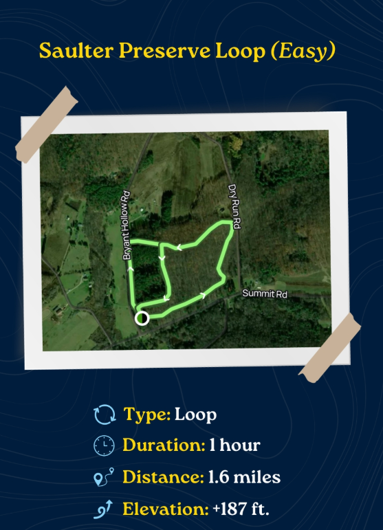
Saulter Preserve Loop (Easy)
Type: Loop
Duration: 1 hour
Distance: 1.6 miles
Elevation gain: +187 ft
Trailhead: Saulter Preserve, near Coudersport, off Bryant Hollow Road
A gentle loop through the fields and woods of Saulter Preserve near Coudersport. Great for families and a quick leg-stretcher.
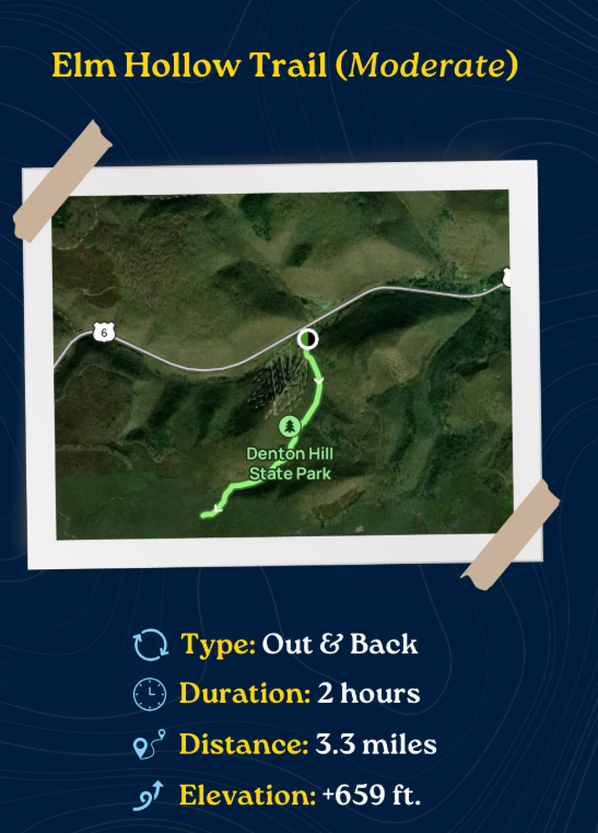
Elm Hollow Trail (Moderate)
Type: Out & Back
Duration: 2 hours
Distance: 3.3 miles
Elevation gain: +659 ft
Trailhead: Denton Hill State Park, U.S. Route 6
Starts off Route 6 and climbs through Denton Hill State Park into a quiet forested hollow.
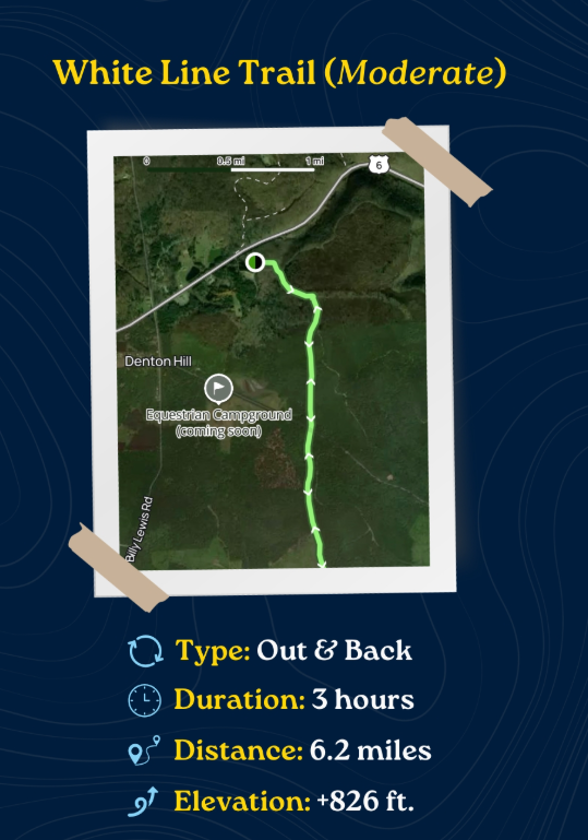
White Line Trail (Moderate)
Type: Out & Back
Duration: 3 hours
Distance: 6.2 miles
Elevation gain: +826 ft
Trailhead: Off U.S. Route 6 near Denton Hill
A longer out-and-back heading south from Route 6 into Susquehannock State Forest near Denton Hill.
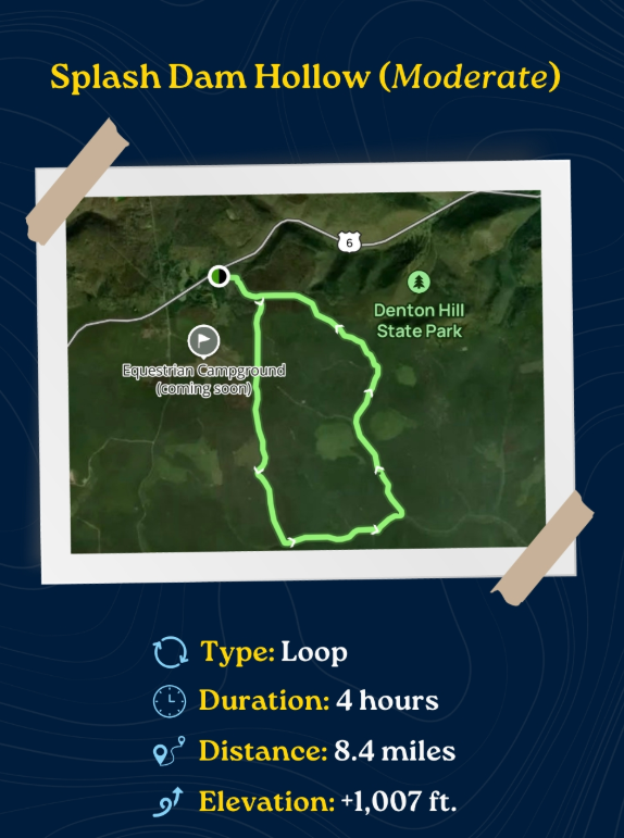
Splash Dam Hollow (Moderate)
Type: Loop
Duration: 4 hours
Distance: 8.4 miles
Elevation gain: +1,007 ft
Trailhead: Off U.S. Route 6, west of Denton Hill State Park
Our favorite half-day loop: a full circuit through the forest just west of Denton Hill State Park.
More Great Hikes
Cherry Springs Interpretive Trail
Easy | Cherry Springs State Park
Short, well-marked forest loop with educational signs. Perfect before a night of stargazing.
Lyman Run State Park Trails
Easy to moderate | Galeton
About 6 miles of trails around the lake at Lyman Run State Park, including the Rock Run Trail to Lyman Lake Vista, about 1.5 miles.
Susquehannock Trail System (STS)
Moderate to difficult | 85-mile loop
One of Pennsylvania's premier backpacking loops through Potter and Clinton counties, marked with orange blazes. The Northern Gateway Trailhead is behind the Susquehannock State Forest District Office on Denton Hill, Route 6, about 9 miles east of Coudersport, with a 0.4-mile access trail to the main loop.
Maps: Susquehannock Trail Club and DCNR.
Hammersley Wild Area
Difficult | Backcountry
More than 30,000 roadless acres in Potter and Clinton counties. For experienced hikers only; limited signage and no cell service.
PA Grand Canyon Trails
Easy to difficult | Wellsboro area
The steep Turkey Path at Leonard Harrison State Park and the flat Pine Creek Rail Trail along the gorge floor.
Kinzua Creek Trail
Moderate | Kinzua Bridge State Park
Descends to the fallen viaduct towers. Check status; closed at times during bridge rehabilitation.
Trail Safety
Carry water, snacks, layers and a headlamp
Wear blaze orange during hunting seasons, fall and spring
Watch for ticks; check yourself after every hike
Give wildlife space, including black bears and rattlesnakes
Pack out everything you bring in
Hike by day, stargaze by night.
Share it with your friends:


Visit Dark Skies PA